This post is also available in:  Español (Spanish)
The Del Mar al Río hiking route was recovered and conditioned, and now hiking enthusiasts can do it any time they want. It is a route that crosses the entire municipality of Teguise, from Costa Teguise to Caleta de Famara. Learn more about this tour below.
Tour around the historic municipality
Whoever visits Lanzarote has a mandatory stop in Teguise. Not only is it the largest municipality on the island, but it also includes some of the most emblematic towns and routes for tourists.
Here is the Real Villa de Teguise, the ancient capital of Lanzarote. In addition, the municipality covers territory from coast to coast of the island and is close to the airport, so you will pass through here at some point.
Within the municipality limits, there is much to see and do. It brings together a group of towns where you will observe the traditional architecture of the island, together with an extensive cultural offer.
On its coasts are two of the most important tourist spots, such as Costa Teguise and Caleta de Famara. These two towns are connected by the Del Mar al Río route. And both are centres of popular sports activities on the island. Diving, snorkelling, windsurfing, and surfing are common on the area’s beaches.
The trail takes visitors through several towns in the municipality. And on this journey, they will enjoy the particular landscapes of Lanzarote and appreciate a sample of its flora and fauna. During the tour, hikers will pass through some ideal spots for bird watching in Lanzarote.
The César Manrique route, the Guasia cisterns, the Guanapay castle, the lime kilns, wells, and mills are some points of interest that you will see along the trail.
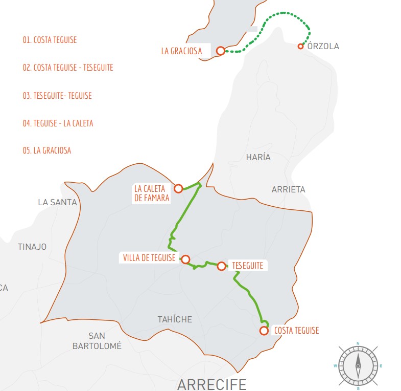
Map source
What is the Del Mar al Río hiking route like in Teguise?
The objective of adapting this route for hikers is to promote ecotourism and responsible tourism. It also promotes the conservation of the patrimonial and ethnographic values of the municipality.
The route crosses Teguise from the east to the northwest, starting in Costa Teguise, and ending in Caleta de Famara, from where there is an open view towards the island of La Graciosa. It extends for a total of 26 kilometres that are covered in approximately six hours. And the maximum height is 397 meters.
It is a wide path, comfortable to walk, and signs throughout the route so that hikers do not have any inconvenience.
The places to stock up on water and food may be far from each other. So it’s important to bring enough supplies when you start.
Its name comes from the fact that it begins by the sea and ends near the “river”, which is what the branch of the sea that separates the island from the volcanoes of La Graciosa is known.
Route
The trail starts in Costa Teguise, in the Los Charcos beach car park. From there, it travels 10.8 kilometres to Teseguite.
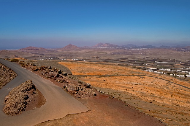
This part of the path runs through stony areas. And as you approach the town, you will see the traditional buildings with white walls, cisterns, farmhouses, and the mountains of Tiniguache and Téjida.
This is the longest part of the route and takes two and a half hours. Only when you get to Teseguite will you find somewhere to buy provisions for the rest of the way, so take precautions.
The ease area in the square where the hermitage of San Leandro is located. From there, it leaves for Teguise, this time on a shorter route of 3.56 km that can be done in one hour. Here you go uphill, and it is where you will find the highest point of the route.
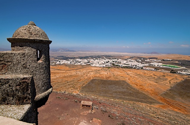
The route passes through the Guanapay volcano, and you can go up to the crater to visit the castle of Santa Bárbara.
From there, you continue to Plaza La Constitución in Teguise, where you can rest next to the church of Nuestra Señora de Guadalupe, before continuing the third part of the journey.
The second-longest section of the route is the one that leads from Teguise to Caleta de Famara, with a total of 11.7 km. The length of this course is two and a half hours. Here you can feel a little more comfortable than in the previous one, because you are going downhill.
Along the way, you will see the limestone kilns, the Jable region. Also, you will pass by the ravines of the Famara massif until you reach the beach, famous for surfing.
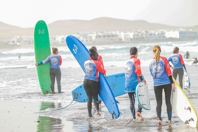 Although the views are beautiful throughout this section, you will have the best view when you are nearing the end. Here, the river and the Chinijo archipelago appear more clearly.
How to get to the trail?
The Del Mar al Río trail in Lanzarote is a new route that will take you through several of the most important points on the island. The departure is in Costa Teguise, from Los Charcos. You can get to Costa Teguise by public transport or by car.
This area is one of the most important tourist spots on the island, and is located just 6 kilometres from Arrecife.
Of course, you can also do the route in the opposite direction, starting from Caleta de Famara. Whichever starting point you choose, this is one of the excursions in Lanzarote that you must do if you like hiking.
What time to start doing the route?
It is best to start the tour early in the morning, to take advantage of the cooler hours of the day. It must be taken into account that the entire Del Mar al Río route takes about six hours, and that you will find few shady places along the way.
Apart from going for an early walk, other recommendations for the tour are:
- Bring plenty of water and food.
- Wear appropriate clothing and shoes.
- Wear sunscreen, a hat, and sunglasses.
- Go accompanied by another person or in groups.
- Take your walk easy, set an appropriate pace for everyone in the group.
And finally, enjoy the views that the Del Mar al Río hiking trail in Teguise gives you. Have you heard about this new route before?
This post is also available in:  Español (Spanish)
